SSC CGL - Detailed Guide 2025
Self-Paced Course
Indian River System
Reference: Lucent GK, NCERT Class 6–12
Description
India’s river system is broadly divided into two main categories based on origin and characteristics:
- Himalayan Rivers (Perennial)
- Peninsular Rivers (Seasonal to Semi-perennial)
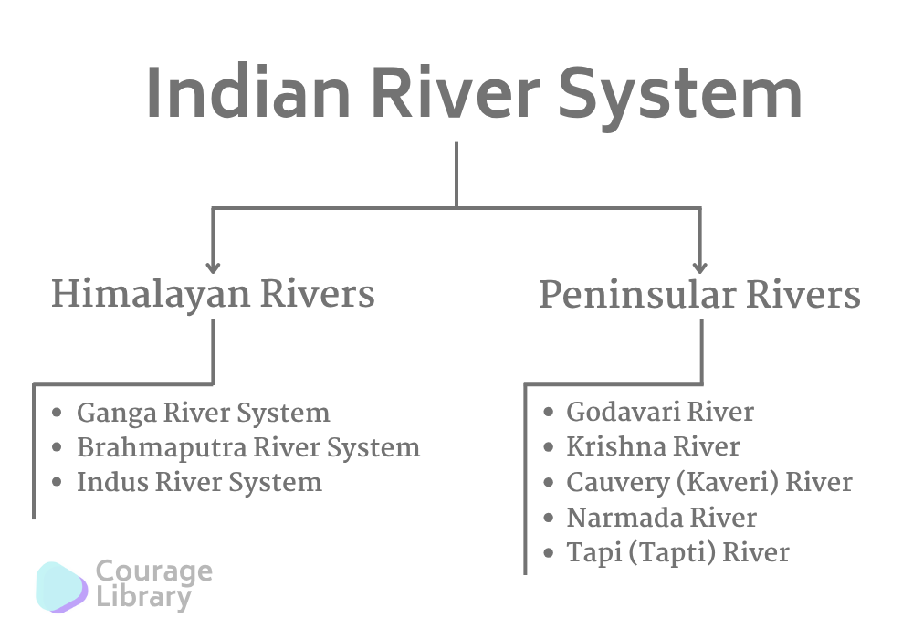
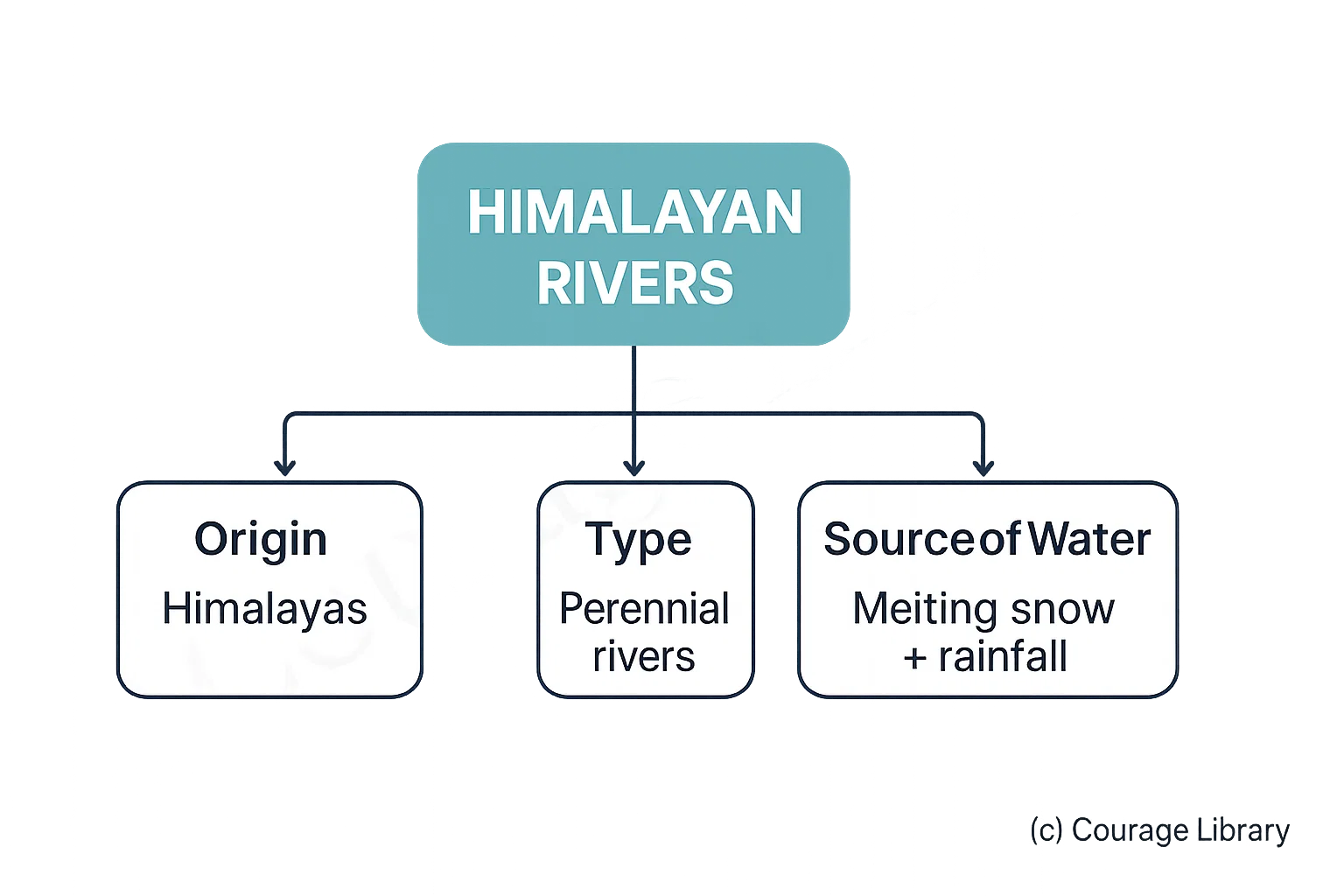
1. Himalayan Rivers
- Originating in the Himalayas.
- These are perennial rivers.
- Fed by both melting snow and rainfall.
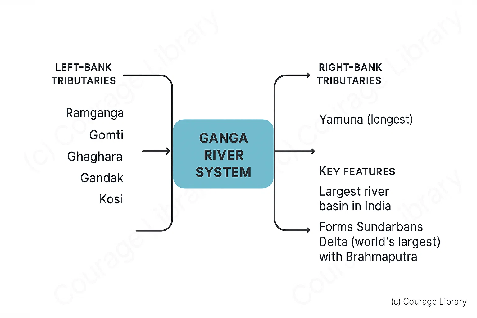
A. Ganga River System
| Features | Details |
|---|---|
| Origin | Gangotri Glacier (Uttarakhand) → Bhagirathi |
| Major Tributary | Alaknanda (joins Bhagirathi at Devprayag to form Ganga) |
| Total Length | ~2,525 km |
| States Covered | Uttarakhand, UP, Bihar, Jharkhand, West Bengal |
| Mouth | Sagar Island (Bay of Bengal) |
Left-bank Tributaries: Ramganga, Gomti, Ghaghara, Gandak, Kosi
Right-bank Tributaries: Yamuna (longest), Son
- Largest river basin in India
- Forms a large delta with Brahmaputra – Sundarbans Delta (World’s largest)
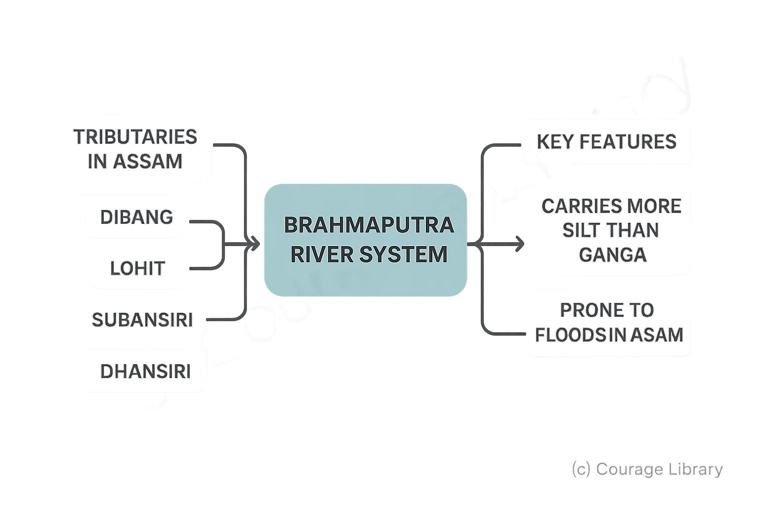
B. Brahmaputra River System
| Features | Details |
|---|---|
| Origin | Chemayungdung Glacier (Tibet) → Tsangpo |
| Enters India | Arunachal Pradesh (as Dihang) |
| Joins Ganga | In Bangladesh → forms Meghna River |
| Length in India | ~900 km |
Tributaries in Assam:
- Dibang
- Lohit
- Subansiri
- Manas
- Dhansiri
Carries more silt than Ganga; prone to floods in Assam
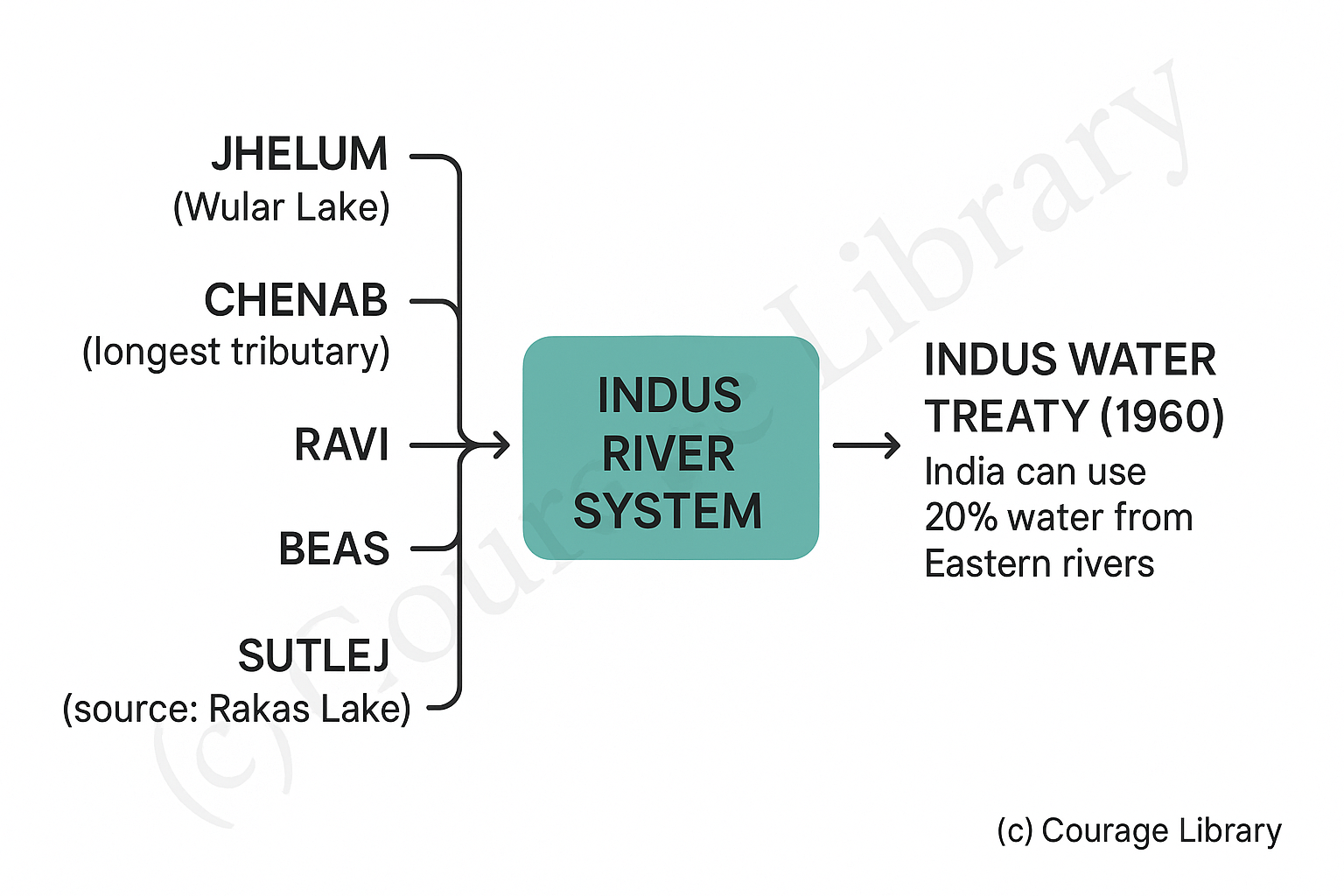
C. Indus River System
| Features | Details |
|---|---|
| Origin | Mansarovar Lake (Tibet) |
| Total Length | ~2,880 km (~1,114 km in India) |
| Enters India | Ladakh region (via Baltistan) |
| Mouth | Arabian Sea |
Major Tributaries:
- Jhelum (Wular Lake)
- Chenab (longest tributary)
- Ravi
- Beas
- Sutlej (source: Rakas Lake)
Indus Water Treaty (1960) – India can use 20% of water from Eastern rivers.
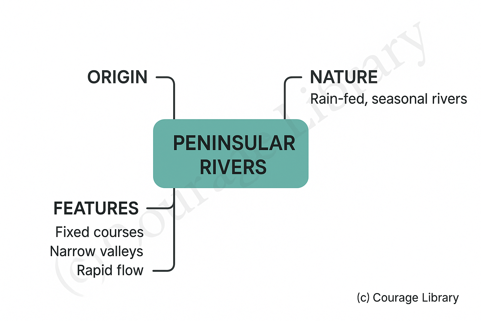
2. Peninsular Rivers
- Originating in the Western Ghats
- These are rain-fed and seasonal rivers
- They have fixed courses, narrow valleys, and flow rapidly.
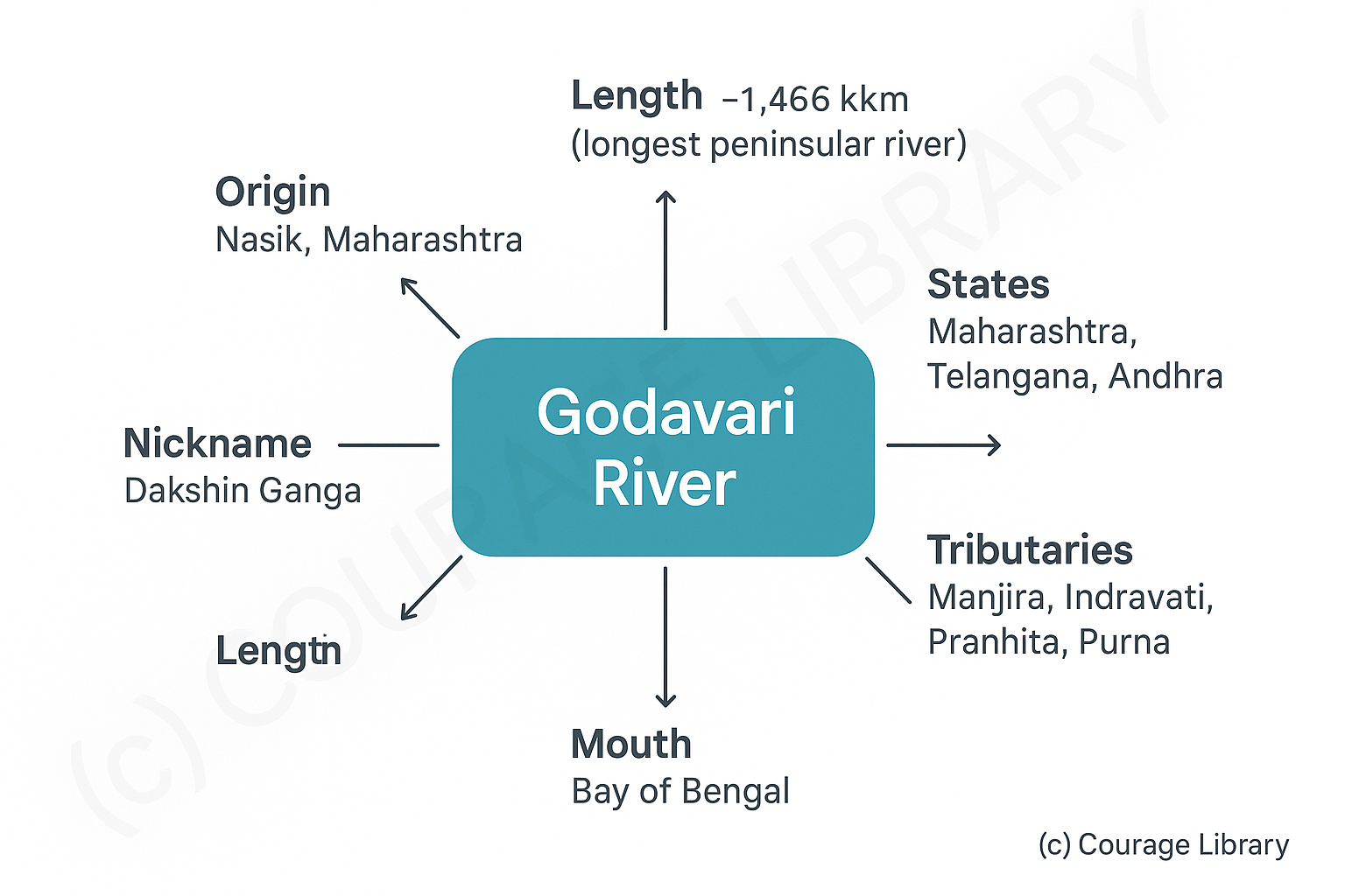
A. Godavari River
- Origin: Nasik, Maharashtra
- Length: ~1,465 km (longest peninsular river)
- States: Maharashtra, Telangana, Andhra
- Mouth: Bay of Bengal
- Nickname: Dakshin Ganga
- Tributaries: Manjira, Indravati, Pranhita, Purna
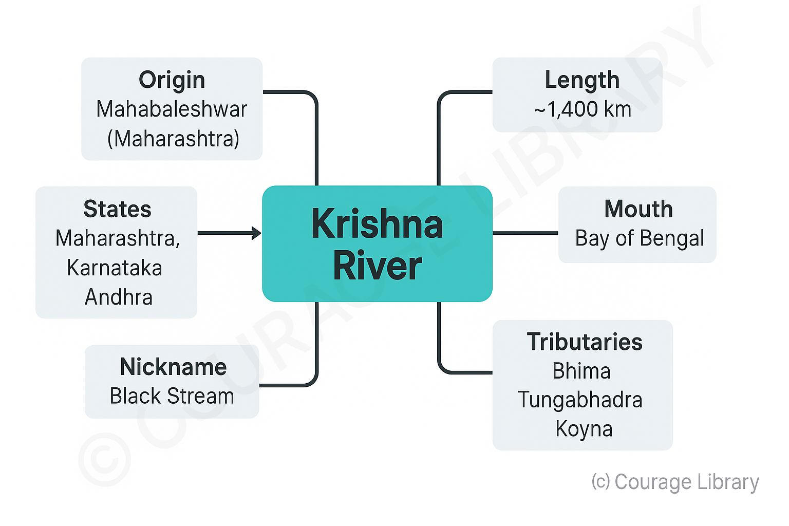
B. Krishna River
- Origin: Mahabaleshwar (Maharashtra)
- Length: ~1,400 Km
- States: Maharashtra, Karnataka, Andhra
- Mouth: Bay of Bengal
- Nickname: Black Stream
- Tributaries: Bhima, Tungabhadra, Koyna
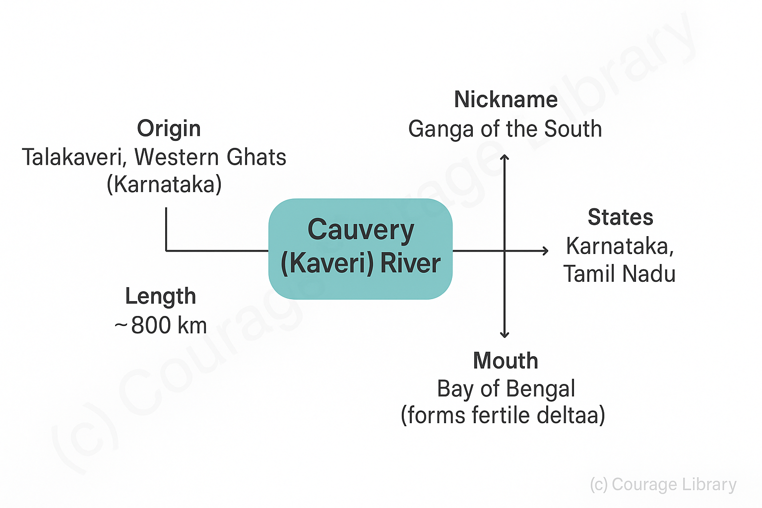
C. Cauvery (Kaveri) River
- Origin: Talakaveri, Western Ghats (Karnataka)
- Length: ~800 Km
- States: Karnataka, Tamil Nadu
- Mouth: Bay of Bengal (forms a fertile delta)
- Nickname: Ganga of the South
- Tributaries: Kabini, Bhavani, Amravati
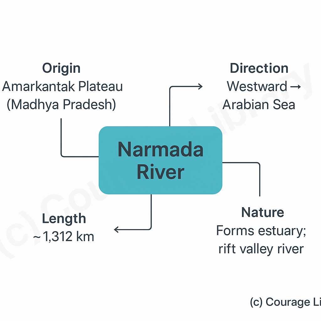
D. Narmada River
- Origin: Amarkantak Plateau (Madhya Pradesh)
- Length: ~1,312 Km
- Direction: Westward → Arabian Sea
- Nature: Forms estuary; rift valley river
- Flow: west-flowing river
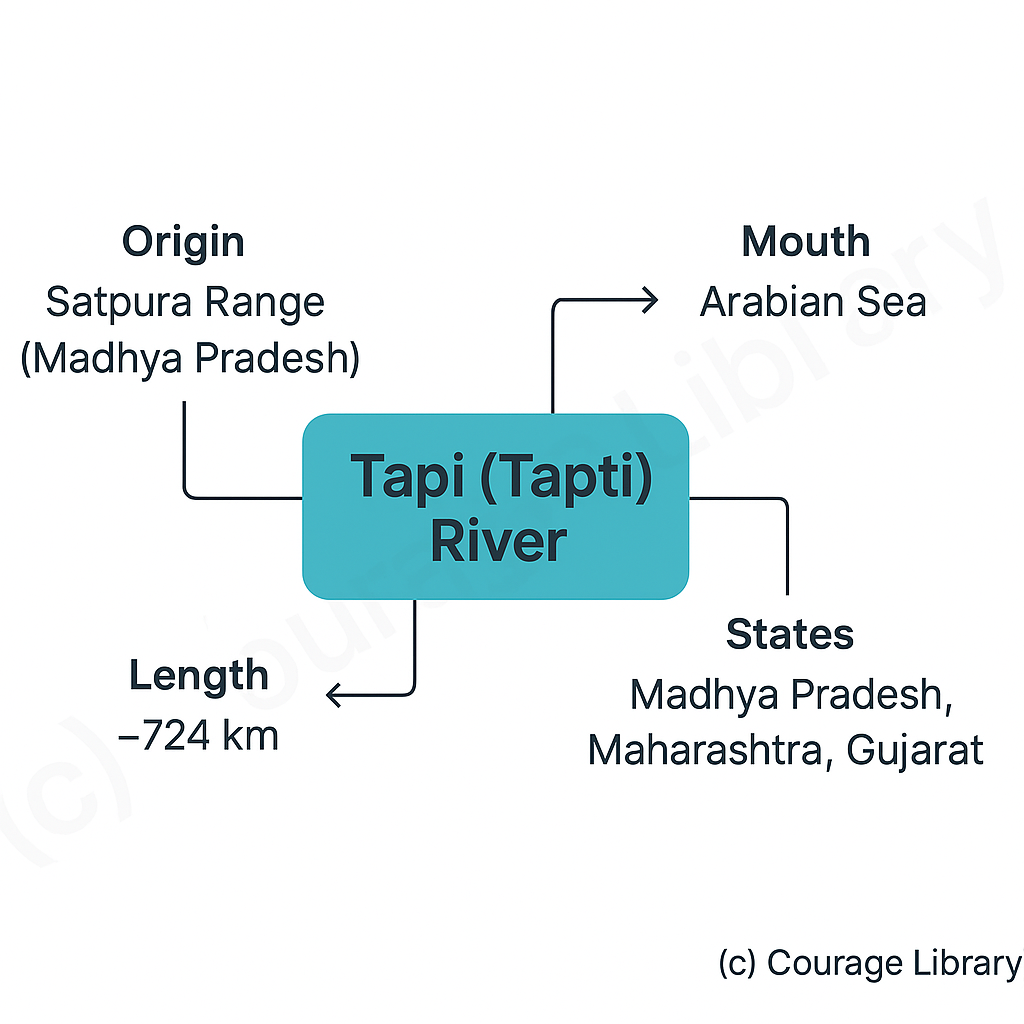
E. Tapi (Tapti) River
- Origin: Satpura range (Madhya Pradesh)
- Length: ~724 Km
- States: MP, Maharashtra, Gujarat
- Mouth: Arabian Sea
- Flow: west-flowing river
3. River Projects & Interlinking
Large-scale river valley projects serve irrigation, hydroelectricity, flood control, and water supply.
| River | Project/Dam | State(s) |
|---|---|---|
| Ganga | Farakka Barrage | West Bengal |
| Yamuna | Tehri Dam | Uttarakhand |
| Godavari | Jayakwadi Dam | Maharashtra |
| Krishna | Nagarjuna Sagar | Telangana/Andhra |
| Cauvery | Mettur Dam | Tamil Nadu |
| Narmada | Sardar Sarovar Project | Gujarat, MP, Maharashtra |
| Mahanadi | Hirakud Dam | Odisha |
| Sutlej-Beas | Bhakra Nangal | Punjab, HP |
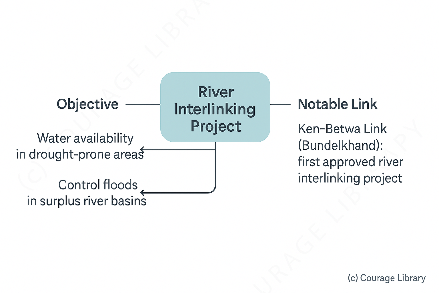
River Interlinking Project:
India's long-term national project to link major rivers to ensure:
- Water availability in drought-prone areas
- Control floods in surplus river basins
Notable Links:
- Ken–Betwa Link (Bundelkhand) — first approved river interlinking project
4. Major Lakes & Wetlands
India has both natural and artificial lakes. Some are tectonic, some glacial, and others formed due to river meandering or human activity.
| Lake | Type | Location | Notes |
|---|---|---|---|
| Wular | FFreshwater (tectonic) | J&K | Largest freshwater lake in India |
| Dal | Freshwater | J&K | Known for houseboats |
| Sambhar | Saltwater | Rajasthan | Largest inland salt lake |
| Chilika | Lagoon (brackish) | Odisha | Largest coastal lagoon in India |
| Pulicat | Lagoon (brackish) | Andhra–TN border | A2nd largest coastal lagoon |
| Vembanad | Brackish | Kerala | Longest lake in India |
| Loktak | Freshwater | Manipur | Phumdis (floating vegetation), Keibul Lamjao NP |
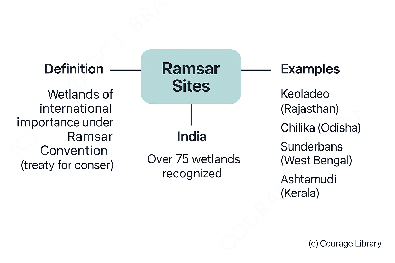
Ramsar Sites:
India has over 75 wetlands recognized under the Ramsar Convention —
a treaty for conservation of wetlands.
Examples:
- Keoladeo (Rajasthan)
- Chilika (Odisha)
- Sunderbans (West Bengal)
- Ashtamudi (Kerala)
Start Your SSC CGL Journey Now!
Join Courage Library to experience disciplined study and expert support.
Be a Couragian!