SSC CGL - Detailed Guide 2025
Self-Paced Course
Physical Features of India
Reference: Lucent GK, NCERT Class 6–12
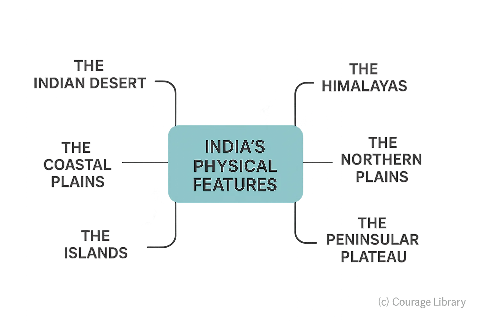
India’s physical features are broadly divided into major divisions:
- The Himalayas
- The Northern Plains
- The Peninsular Plateau
- The Indian Desert
- The Coastal Plains
- The Islands
1. The Himalayas
India’s youngest, most recent fold mountain system formed by the collision of the Indian and Eurasian plates.
| Feature | Details |
|---|---|
| Age | ~40–50 million years (Tertiary period) |
| Extent | From Indus (J&K) to Brahmaputra (Arunachal Pradesh) – ~2,500 km |
| Width | Varies from 400 km (Kashmir) to 160 km (Arunachal) |
| Composition | Sedimentary rocks; tectonically unstable; prone to earthquakes |
Three parallel ranges (from North to South):
| Range | Features |
|---|---|
| Himadri (Greater Himalayas) | Highest range; contains most snow peaks and glaciers; Mt. Everest (Nepal), Kanchenjunga (India) |
| Himachal (Lesser Himalayas) | Forested valleys and hill stations like Shimla, Mussoorie |
| Shiwalik (Outer Himalayas) | Youngest, low-height hills; contains Bhabar and Terai belts |
Divisions (from west to east):
- Kashmir / Punjab Himalayas
- Kumaon Himalayas
- Nepal Himalayas
- Assam / Arunachal Himalayas
2. The Northern Plains
Formed by deposition of alluvium brought by Himalayan rivers — Indus, Ganga, Brahmaputra.
| Feature | Details |
|---|---|
| Area | ~7 lakh sq km |
| Width | 150–300 km |
| Length | ~2,400 km |
| Soil | Fertile alluvial soil |
| Population | Most densely populated area in India |
Divided into 3 regions:
| Region | River System | Features |
|---|---|---|
| Punajb Plains | Indus system | Western part; mostly in Pakistan now |
| Ganga Plains | Ganga-Yamuna | UP, Bihar, parts of West Bengal |
| Brahmaputra Plains | Brahmaputra | Assam and northeastern part |
Alluvial plain subdivisions:
- Bhabar – pebble-laden strip along foothills
- Terai – marshy zone, south of Bhabar
- Bhangar – old alluvium, slightly elevated
- Khadar – new alluvium, highly fertile
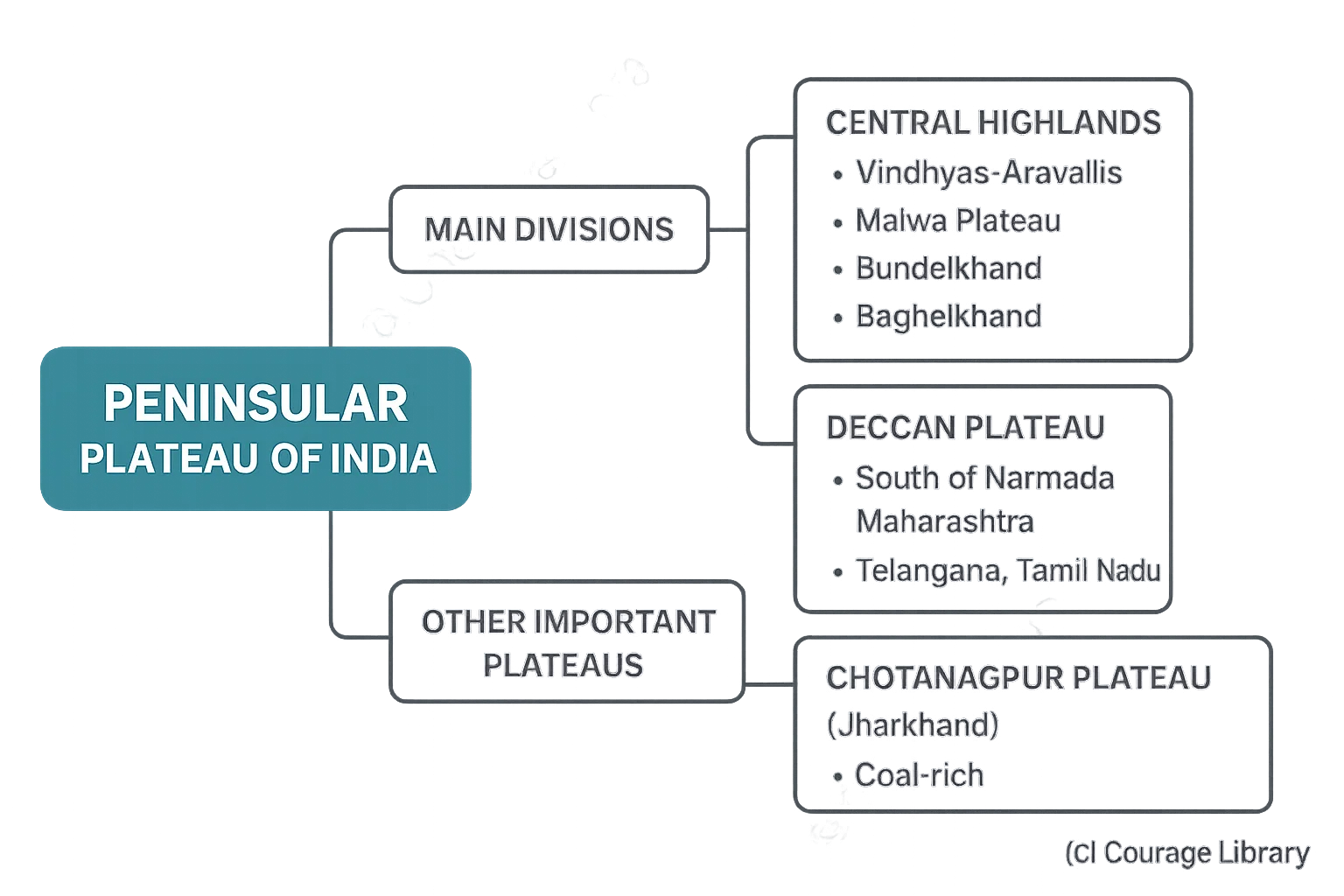
3. The Peninsular Plateau
Oldest landmass of India; part of Gondwana land; highly stable and rich in minerals.
| Feature | Details |
|---|---|
| Age | Precambrian (>2.5 billion years) |
| Nature | Hard, crystalline rocks; dissected by rivers |
| Shape | Triangular; bounded by Aravallis (NW), Ghats (E & W) |
Two main divisions:
-
Central Highlands
- Between Vindhyas & Aravallis
- Malwa Plateau, Bundelkhand, Baghelkhand
-
Deccan Plateau
- South of Narmada River
- Maharashtra, Telangana, Karnataka, Tamil Nadu
- Black soil (Regur) in northwestern part — ideal for cotton
Other Important Plateaus:
- Chotanagpur Plateau (Jharkhand): Coal-rich
- Meghalaya Plateau: Separated by Garo-Khasi-Jaintia Hills
4. Coastal Plains & Islands
India has a coastline of about 7,516 km (mainland: ~6,100 km)
Coastal Plains
| Coast | States Covered | Characteristics |
|---|---|---|
| Western Coast | Gujarat to Kerala (Konkan, Kannad, Malabar) | Narrow, steep, estuaries (suitable for ports) |
| Eastern Coast | West Bengal to Tamil Nadu (Northern & Coromandel) | Wide, deltaic (e.g., Ganga, Mahanadi, Godavari, Krishna) |
Islands
| Group | Location | Notes |
|---|---|---|
| Andaman & Nicobar | Bay of Bengal | Volcanic origin (e.g., Barren Island – active volcano); important for security |
| Lakshadweep | Arabian Sea | Coral atolls; flat terrain; smallest UT |
5. The Indian Desert (Thar Desert)
Located in western Rajasthan, bordering Pakistan.
| Feature | Details |
|---|---|
| Rainfall | <150 mm annually; driest part of India |
| River | Luni – only seasonal river |
| Soil | Sandy; poor in moisture retention |
| Wind Features | Sand dunes (barchans, seifs) |
| Cause | Aravalli range lies parallel to SW monsoon → no rainfall barrier |
6. Drainage Systems
India has two major drainage systems:
| System | Description |
|---|---|
| Himalayan Rivers | Perennial (snow + rain fed); meandering & long courses |
| Peninsular Rivers | Seasonal (rain-fed); more straight; higher erosion capacity |
Major River Systems:
| River | Origin | Flows Through | Empties Into |
|---|---|---|---|
| Ganga | Gangotri Glacier | UP, Bihar, Bengal | Bay of Bengal |
| Brahmaputra | Tibet (Tsangpo) | Arunachal, Assam, Bangladesh | Bay of Bengal |
| Indus | Tibet (Sengge Zangbo) | J&K, Pakistan | Arabian Sea |
| Godavari | Nasik (Maharashtra) | Maharashtra, Telangana, Andhra | Bay of Bengal |
| Krishna | Mahabaleshwar | Maharashtra, Karnataka, Andhra | Bay of Bengal |
| Narmada | Amarkantak Plateau | MP, Gujarat | Arabian Sea (Westward) |
| Mahanadi | Chhattisgarh | Odisha | Bay of Bengal |
| Kaveri | Karnataka | Tamil Nadu | Bay of Bengal |
- East-flowing rivers form deltas.
- West-flowing rivers form estuaries.
Summary Table
| Type | Name | Key Properties | Notes |
|---|---|---|---|
| River | Ganga | Longest river in India (2,525 km), perennial, originates from Gangotri glacier | Bhagirathi in origin; forms fertile Northern Plains |
| River | Yamuna | Major tributary of Ganga, joins at Prayagraj | Originates from Yamunotri glacier |
| River | Brahmaputra | Originates in Tibet (Tsangpo); joins Ganga in Bangladesh | Called Tsangpo (Tibet), Jamuna (Bangladesh) |
| River | Indus | Major river of northwestern India, originates in Tibet | Flows mostly through Pakistan |
| River | Godavari | Longest river of Peninsular India (~1,465 km), delta-forming | Dakshin Ganga (South Ganga) |
| River | Krishna | Flows through Maharashtra, Karnataka, Andhra | Second-longest Peninsular river |
| River | Narmada | West-flowing river, forms estuary | Originates from Amarkantak Plateau |
| River | Kaveri | East-flowing river, known for irrigation & hydro projects | Called Dakshina Ganga (also) |
| Mountain | Himalayas | Young fold mountains, snow-covered, tectonically active | Contains world’s highest peaks |
| Mountain | Aravalli | Oldest mountain range in India, NW direction | Highly eroded; Protects Thar Desert |
| Mountain | Western Ghats | Runs parallel to west coast; biodiversity hotspot | Sahyadri (Maharashtra part) |
| Mountain | Eastern Ghats | Broken hills along east coast | Lower in height than Western Ghats |
| Mountain | Karakoram Range | Located in Ladakh region; contains K2 (India’s highest peak in PoK) | Also called Trans-Himalayas |
| Plain | Northern Plains | Formed by alluvial deposits of Ganga, Indus, Brahmaputra | Densely populated; agriculturally rich |
| Plain | Punjab Plains | Formed by Indus system | Now majorly in Pakistan |
| Plain | Brahmaputra Plains | Located in Assam; formed by Brahmaputra River | Prone to floods |
| Desert | Thar Desert | Lies in western Rajasthan; sandy terrain; arid climate | Great Indian Desert |
| Plateau | Deccan Plateau | Triangular, basaltic rocks, volcanic origin | Bordered by Western & Eastern Ghats |
| Plateau | Chotanagpur Plateau | Mineral-rich area in Jharkhand | Known as “Ruhr of India” (due to mineral concentration) |
| Plateau | Malwa Plateau | Located in Madhya Pradesh | Between Aravalli and Vindhya ranges |
| Plateau | Meghalaya Plateau | Part of Shillong Plateau; separated by Garo-Rajmahal Gap | Comprises Garo, Khasi, Jaintia Hills |
| Island | Andaman & Nicobar Islands | Volcanic origin; located in Bay of Bengal | Barren Island – India’s only active volcano |
| Island | Lakshadweep Islands | Coral origin; located in Arabian Sea | Smallest Union Territory |
| Island | Majuli | Riverine island in Assam; formed by Brahmaputra | World’s largest river island (area-wise) |
| Island | Sriharikota | Coastal barrier island (Andhra Pradesh) | Location of ISRO's satellite launch center |
Start Your SSC CGL Journey Now!
Join Courage Library to experience disciplined study and expert support.
Be a Couragian!